
Urban Geography 5
The major models of urban structure

The major models of urban structure
There are several major models or theories that describe the structure of urban areas. These models help us understand the spatial patterns and organisation of cities. Here are four significant models:
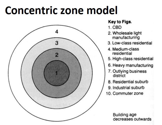
Concentric Zone Model (Burgess Model): The Concentric Zone Model, proposed by sociologist Ernest Burgess in 1925, describes a city's structure as a series of concentric rings radiating from the central business district (CBD). The model suggests that cities grow outward in a series of zones:
CBD: The central business district, where commercial and office activities are concentrated.
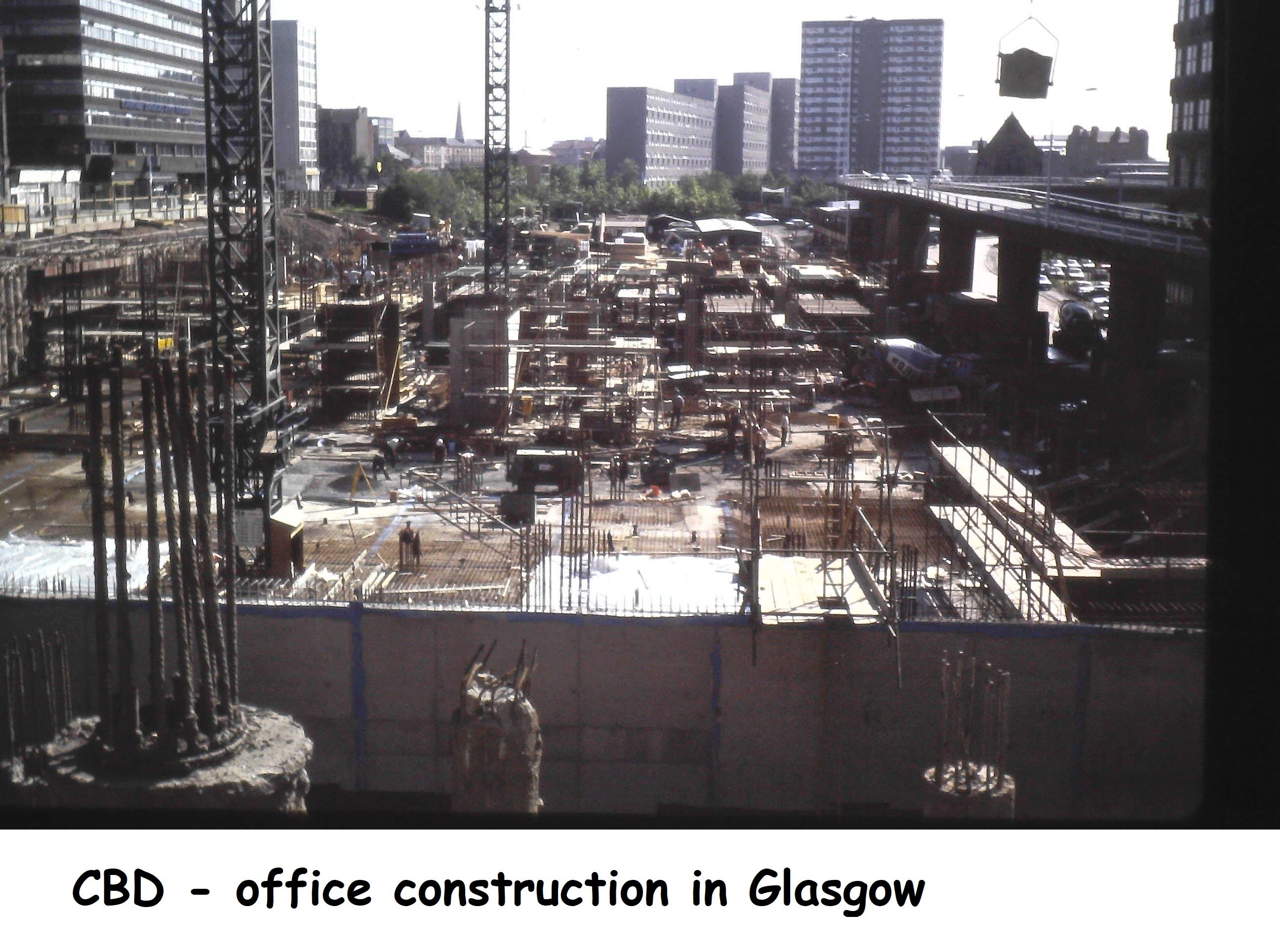
Zone of Transition: Surrounding the CBD, this zone often exhibits mixed land uses, including older housing, industry, and deteriorated buildings.
Zone of Working-Class Homes: This zone consists of modest residential areas occupied by blue-collar workers.
Zone of Better Residences: This zone includes middle-class residential areas characterized by single-family homes, parks, and schools.
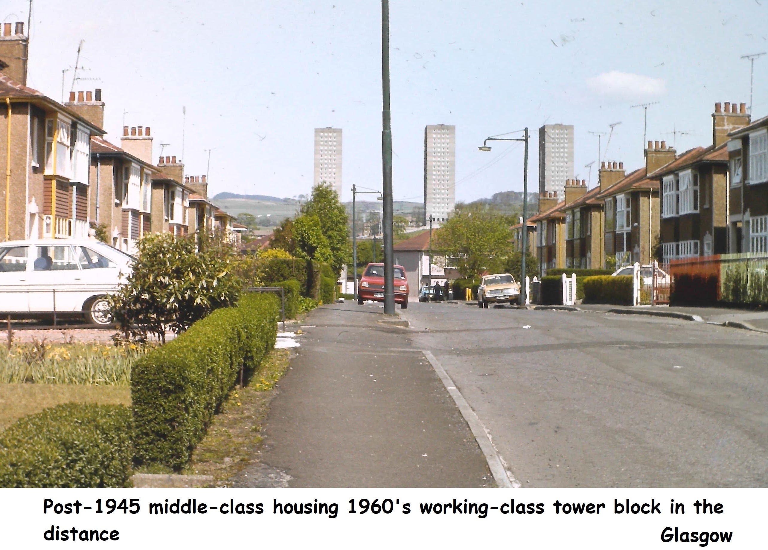
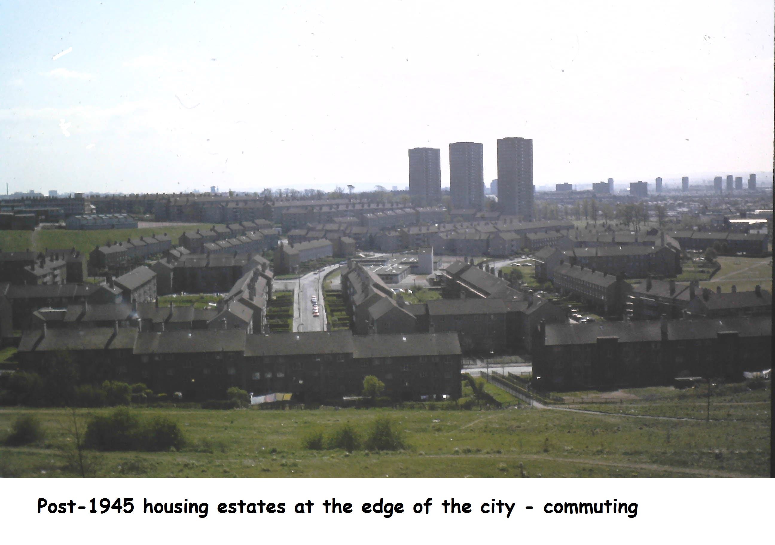
Commuter Zone: The outermost zone consists of suburban areas where people live and commute to work in the city.
Sector Model (Hoyt Model): Proposed by economist Homer Hoyt in 1939, the Sector Model suggests that cities develop in pie-shaped sectors or wedges, with their growth driven by transportation routes and socioeconomic factors. The model emphasizes the influence of transportation corridors on the spatial distribution of different land uses:
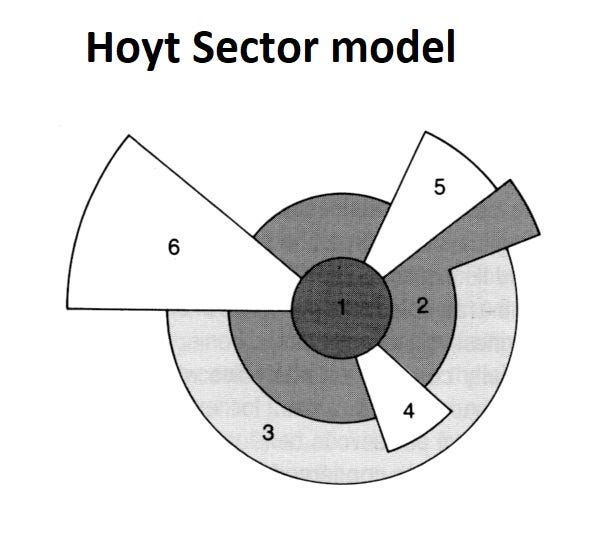

CBD: The central business district remains the focal point of the city.
Transportation/Industrial Corridors: Industrial and transportation activities tend to extend along major roads, rail lines, or waterways.
Low-Class Residential Areas: Low-income housing often occupies areas adjacent to industrial zones.
Middle-Class Residential Areas: These areas form in sectors extending from the CBD towards desirable amenities or natural features.
High-Class Residential Areas: The wealthiest residential areas develop in sectors farthest from the CBD, often taking advantage of scenic views or suburban environments.
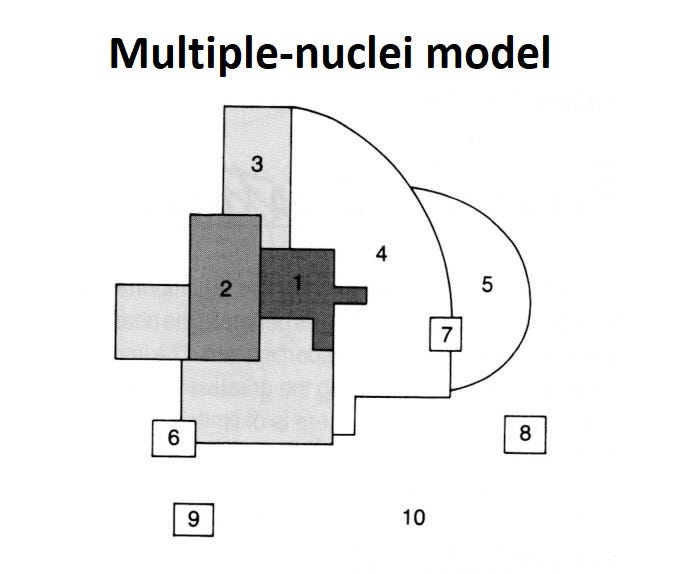

Multiple Nuclei Model: The Multiple Nuclei Model, proposed by geographers Chauncy Harris and Edward Ullman in 1945, suggests that cities are not dominated by a single CBD but have multiple centres of activity or nuclei. Different land uses and functions develop around these nuclei based on their attractiveness and complementarity:
CBD: The primary central business district remains an important nucleus.
Retail Nuclei: Additional commercial centres, such as shopping malls or specialised markets, develop outside the CBD.
Industrial Nuclei: Manufacturing and industrial areas may have their own nuclei, often located near transportation routes or resource-rich areas.
Residential Nuclei: Residential areas, including suburbs, may have their own nuclei, especially for specific social or income groups.
Institutional Nuclei: Schools, hospitals, universities, or cultural centres can act as independent nuclei within the city.
Urban Realms Model (Galactic City Model): Developed by James Vance and David E. Dougherty in 1964, the Urban Realms Model describes modern metropolitan areas that have multiple suburban centres or "edge cities" around a central city. It reflects the decentralization of economic activities and the growth of suburban areas:
Central City: Similar to the CBD in other models, the central city remains the historical core of the metropolitan area.
Edge Cities: Several suburban centres develop independently of the central city, acting as commercial, office, and residential hubs. These edge cities often have their own employment opportunities and amenities, reducing the need for commuting to the central city.
Transportation Corridors: Major transportation routes connect the central city and edge cities, shaping the spatial development of the metropolitan area.
Suburban Residential Areas: Suburban neighbourhoods surround the edge cities, providing housing for the population and often connected to the central city and edge cities by transportation routes.
The main difference between the urban realms model and the multiple nuclei model is that the urban realms model sees mega-cities as collections of several little realms (i.e. self-sustaining cities) that are interconnected. By contrast, the multiple nuclei model sees cities as one single city-realm with multiple nuclei (commercial districts) within it.
It's important to note that these models provide simplified representations of urban structure and have limitations in capturing the complexity and uniqueness of individual cities. Nonetheless, they offer valuable insights into the historical and spatial patterns of urban development and help in urban planning and policy-making processes.
In addition to these major models of Urban Structure which were largely based on cities in the USA, it is worth noting the -
Mann model of the British City
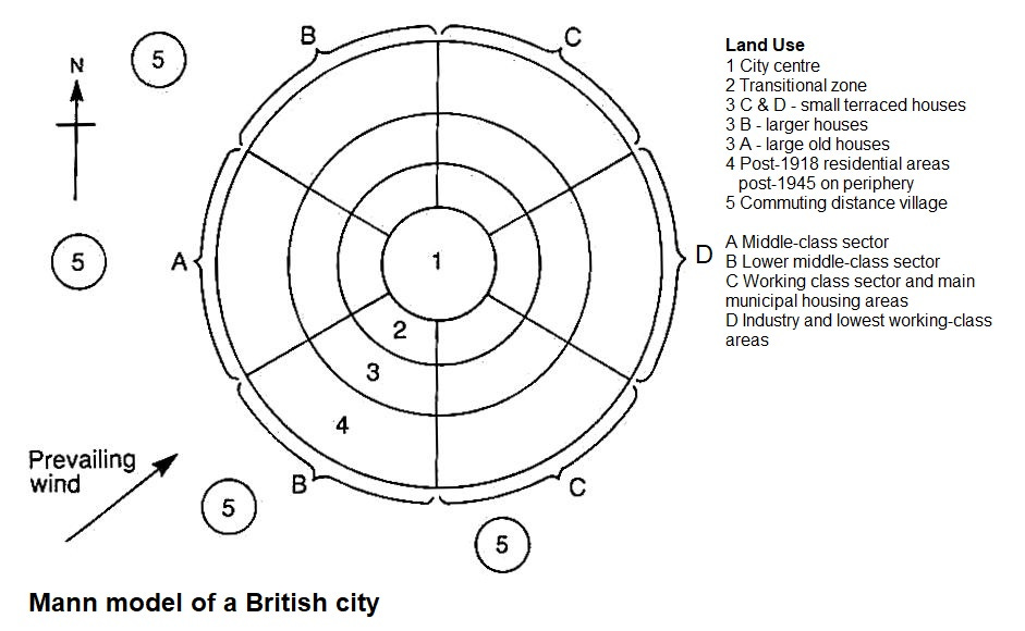
The Mann model (1965) can be considered as a composite model containing concentric zones and sectors. Mann further shaped the pattern by introducing the influence of the direction of the prevailing wind. Mann argued that high-value housing would be built in areas away from the outfall zones of wind-borne pollution. This was particularly so during the Industrial Revolution when less polluted areas would be in western parts of the city and the most polluted towards the east. The model reflects more accurately the periods of growth and land use of British cities. However, the model is now a bit dated as many deindustrialised cities have undergone significant redevelopment.
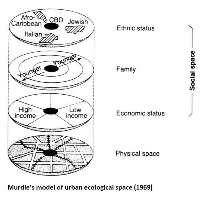
There are other models of Urban structure I won’t detail an explanation but will present one other model for readers to consider.
Question
1 What are the drawbacks of the concentric ring model and Hoyt model of urban structure?
2 Which model of urban structure may be of most relevance to urban areas today?
FEEL FREE TO BUY ME A COFFEE IF YOU LIKE MY FREE RESOURCES
or one of my inexpensive books at
Amazon.co.uk: Ritchie Cunningham: books, biography, latest update